Academician Guo Huadong: Space Technology Escorts The Belt And Road Initiative To Build A "digital Silk Road"

Academician Guo Huadong: Space Technology Escorts The Belt And Road Initiative To Build A "digital Silk Road"
Academician Guo introduced that the DBAR plan is first of all, and secondly, to promote exchanges and cooperation between countries along the route, serve the Belt and Road Initiative, and at the same time achieve the United Nations Sustainable Development Goals.

Academician Guo Huadong, a researcher and doctoral supervisor of the Chinese Academy of Sciences
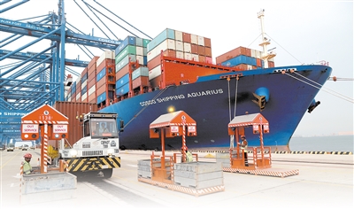
The construction of the "Belt and Road" is a key link in global governance, an important practice in building a community with a shared future for mankind, and a breakthrough and overall global initiative and national strategy, with the characteristics of a wide range, a long cycle and a wide field.
It is of great significance to conduct macro- and dynamic analysis of the ecological environment pattern and development potential of countries along the "Belt and Road" to provide basic and macro-environmental data for the construction of the "Belt and Road".
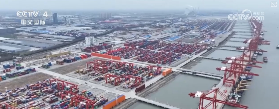
Space technology can image large-scale land objects in the shortest time, conduct real-time imaging of emergency emergencies, and provide quantitative information on phenomena within a large area, which has become the prerequisite for serving the "Belt and Road".
At present, there are mainly the following types of space technologies: space remote sensing technology, space navigation technology, space communication technology, etc. These are collectively called space earth observation technology. Space earth observation technology has the characteristics and ability to obtain data macroscopically, quickly, accurately and objectively, and is an effective means to achieve environmental observation. Provide spatial information technology research and development, which can provide spatial information technology support to countries along the route.
As the "Belt and Road" International Cooperation Summit Forum is about to be held, Academician Guo Huadong, director, researcher and doctoral supervisor of the Center for Earth Observation and Digital Earth Sciences of the Chinese Academy of Sciences, talks about the "Belt and Road" and how to build the "Digital Silk Road" from the perspective of space technology.
How does space technology escort the Belt and Road Initiative?
Academician Guo Huadong mentioned three aspects:
Resources, environment, disasters.
In terms of environment, the ecological environment of many countries along the "Belt and Road" is very fragile. If we can use the big data detected by satellites to conduct past, present and future detection and simulation, it can provide a very important foundation for the government to formulate the development of the ecological environment.
Academician Guo introduced the example of the Ministry of Environmental Protection and scientists from the Chinese Academy of Sciences doing decade-long changes in ecological. If it is put into the "Belt and Road" countries, the same results will be achieved.

In terms of resources, there are many fields involved, and it is very important to use space technology to conduct background investigations of resources. For example, in the agricultural field, the most important thing is to estimate grain output. Earth observation technology can observe its planting area, monitor its growth, and finally estimate the yield.
This makes a greater contribution to futures trade and food security. Especially the Belt and Road countries are facing challenges in food issues of one kind, and space technology can provide such information support.
In terms of disaster monitoring, according to statistics, 85% of the world's major disasters occur in the "Belt and Road" areas. According to research, 80% of the disasters with the largest number of deaths and the worst economic losses in the world (earthquakes, storm surges and flood and drought disasters) also occur in this area. Using space observation technology to detect and evaluate large-scale flood and drought disasters, fires, earthquakes and storm surges is of great effect.
Of course, space technology can play a great role in other aspects, such as the development of urbanization, transportation layout, monitoring and protection of natural and cultural heritage, etc.
my country's ground observation: It will enter the first echelon in the future
After 40 years of development in my country's space observation technology, data acquisition technologies such as independent satellite remote sensing technology and Beidou navigation satellite technology have made great progress. The corresponding ground reception infrastructure and data processing system level, scale and service capabilities are also at the forefront of the world's peers.
Our country is a major country for earth observation, but it is still hard to say that it is a strong country. However, our country has the conditions to become a powerful land observation power.
First, the 40-year development history has been deeply accumulated; second, space technology is the cause of a big country, both on land and on oceans; third, my country is a developing country with deterioration in the environment, poor resources, and a high degree of demand; fourth, the government has always attached great importance to space technology. In recent years, the development of ground observation technology has been rapid, and overall it is approaching the world's advanced level, and some fields are already ahead.

Academician Guo Huadong gave a metaphor, it was like running a marathon. Sometimes we could run to the first echelon, but most of the time we were still in the second echelon. Generally speaking, we were at the forefront of the second echelon. After 10 years, we can be expected to become a first-class earth observation power.
"Digital Silk Road" International Science Plan
Taking the "One Generation, One Road" plan as an opportunity, the Digital Silk Road cooperation project initiated by Chinese scientists can be said to be an opportunity.
In May 2016, the International Conference on Space Cognition of the Belt and Road Initiative launched the "Digital Silk Road" International Science Plan, referred to as DBAR, which received responses from many countries.
After initiation, after half a year of work, the core plan of the "Digital Silk Road" was formed, the DBAR Science Committee was established, and nine working groups were established, and the draft of the DBAR Science Plan was passed. In December 2016, the DBAR plan officially began.

The "Digital Silk Road" International Science Plan takes Earth's big data as scientific support, promotes cooperation and exchanges among countries along the "Belt and Road" and a series of prominent scientific research issues faced in the process of achieving the United Nations Sustainable Development Goals.
Academician Guo introduced that the DBAR plan is first of all, and secondly, to promote exchanges and cooperation between countries along the route, serve the Belt and Road Initiative, and at the same time achieve the United Nations Sustainable Development Goals.
DBAR is a pioneering international program aimed at supporting the sustainable development of the Belt and Road and sharing data, technology, knowledge and experience in the fields of earth observation and earth big data. It will take action against the United Nations Sustainable Development Goals, use ground observation technology, and adopt a green, low-carbon and sustainable approach to achieve scientific and technological decision-making support contributions to the social and economic development of the Belt and Road.